
Hackensack ZIP Coverage
Hackensack’s documented postal picture has a core street-delivery ZIP, a second Hackensack postal label that needs address-by-address confirmation, and nearby codes served by the same processing operation. The ZIP code directory should keep those roles distinct. USPS delivery geography is not a municipal-boundary map. For Hackensack city, tax, and parcel work, use the returned municipality and Bergen County records alongside the postal result.
| ZIP | Areas Covered | Post Office | Notes |
|---|---|---|---|
| 07601 | Standard Hackensack street-delivery addresses. | Hackensack Post Office, 226 State Street. | Postal geography is delivery-based, not a city-line map. |
| 07602 | Hackensack postal label in USPS bulletin material. | Confirm through USPS for the individual address or box. | Treat as a PO-box or unique-delivery label unless current USPS detail confirms its use. |
| 07603–07608 | Nearby Bergen postal areas, not additional Hackensack city ZIPs by service-center association alone. | South Hackensack Sorting and Delivery Center serves these codes operationally. | Use a specific address before associating one with Hackensack. |
| 07643 | Nearby Bergen postal area served operationally by the same center. | South Hackensack Sorting and Delivery Center. | Do not call it a Hackensack ZIP without address validation. |
The official USPS Hackensack location record is the source for this Hackensack ZIP reference image.
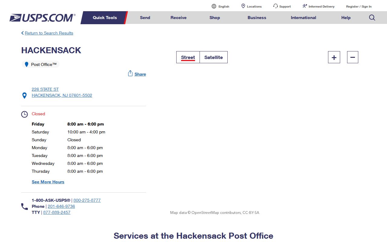
The USPS page identifies the Hackensack Post Office at 226 State Street, 07601-5502, and lists retail and PO-box access separately. The research captured retail hours of Monday through Friday, 8:00 a.m. to 6:00 p.m., and Saturday, 10:00 a.m. to 4:00 p.m.; check USPS before a visit because hours can change.
Hackensack ZIP 07601
07601 is the core street-delivery ZIP identified for Hackensack. That makes it the usual postal starting point for an ordinary city street address, but a ZIP alone still does not identify the parcel or its municipal jurisdiction. Entering only 07601 into a general property workflow can join many unrelated locations. Start with the full street number, name, unit, city, and ZIP, then retain the exact form returned by the postal and municipality tools.
For Hackensack record work, keep two columns in a note: postal address and government parcel address. A matching city name can be helpful. The block, lot, qualifier, and PAMS PIN carried by county GIS are stronger bridges to an assessment record or deed. This distinction matters in a dense county-seat city where a street address may identify a multi-unit property, a civic location, a business, or a condominium rather than one household.
Note: A postal ZIP validates delivery information; it does not establish present occupancy or recorded ownership.
What Hackensack 07602 Means
USPS postal-bulletin material identifies 07602 with a Hackensack label. The research did not expose a complete live USPS table that classifies every use or draws a boundary for that code. For that reason, treat 07602 as a PO-box or unique-delivery label unless an address-specific USPS lookup gives a more precise current answer. Do not assign ordinary Hackensack street parcels to 07602 merely because the label says Hackensack.
This is a practical delivery limit, not a missing municipal neighborhood. A Hackensack box address is a delivery point. It should not be converted into a street parcel, mapped to a block and lot, or used as a substitute for a physical location. The Hackensack city, county assessment system, and GIS have different roles and should be consulted only when a real street address is available.
Verify a Hackensack ZIP Address
Use both state and postal channels when a Hackensack address is unclear. For Hackensack, the New Jersey municipality tool is designed to distinguish the standardized municipality from a mailing-city or ZIP label. Its inspected form requires a street address with autocomplete and permits city, state, and ZIP as added inputs. Then compare that municipal response with the parcel’s municipality in Bergen GIS. USPS supplies the delivery side of the check.
- Enter the complete address in the USPS address or ZIP lookup route. Preserve the postal spelling and ZIP returned for that address.
- Enter the same street address in the New Jersey Municipality Lookup. Use its autocomplete result instead of guessing the municipal label.
- Check the Bergen GIS or assessment result for the Hackensack municipality and the parcel’s PAMS PIN, block, lot, and qualifier.
- Keep the ZIP as a postal field and the returned municipality as a government field. For a box, retain the box address without converting it into a parcel.
| Municipality lookup field | Form behavior | How it helps |
|---|---|---|
| Street address | Required, with autocomplete. | Supplies the location the tool standardizes. |
| City | Optional added input. | Useful as a check, not a replacement for the returned municipality. |
| State | Optional added input. | Constrains the address to New Jersey when needed. |
| ZIP | Optional added input. | Tests a postal value without treating it as the municipal answer. |
| Lookup Address | Form control. | Returns the municipality result after a street address is supplied. |
New Jersey Municipality Lookup is the source for this Hackensack ZIP reference image.
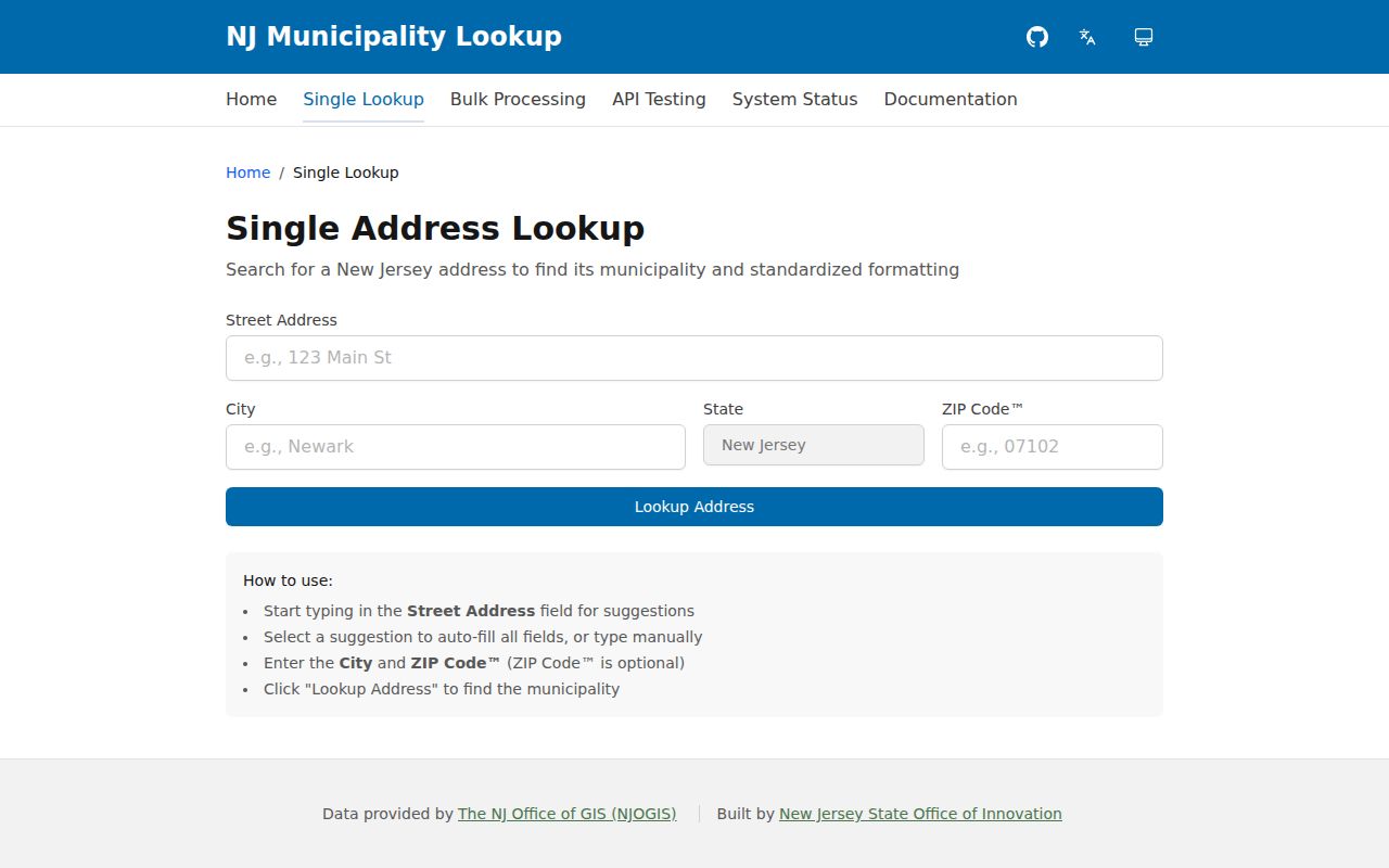
Use the state result to resolve municipality questions, then use the postal result for mail delivery. Neither response replaces the legal description or county parcel identifier used by deeds and tax records.
Hackensack ZIP Search Limits
Research did not confirm a public ZIP-wide resident search for Hackensack. The county assessment portal used for Hackensack exposes database, county, district, search format, output format, items-per-page, location, owner name, block, lot, and qualifier controls. Its option lists were not visible during inspection, so do not assume that ZIP is an available or complete filter. A search by exact address, owner, or parcel identifier is the documented route.
The state voter search is also person-first, not a ZIP or block directory. Its live result view was unavailable during research, and the documented input pattern uses identifying fields. If a ZIP has narrowed a Hackensack address, continue through the parcel system and then use a person’s voter status only as a limited corroborating check. For the full street-level record chain, use the Hackensack By Street page.
South Hackensack ZIP Service
Postal processing service and municipal geography are different systems. In a June 13, 2026 bulletin, USPS announced activation of the South Hackensack Sorting and Delivery Center at 560 Huyler Street. The bulletin says that operation serves 07601, 07603 through 07608, and 07643. It is useful context for a delivery question, but it does not redraw Hackensack’s city boundary or make every served ZIP a Hackensack postal code.
When a nearby Bergen ZIP appears in a Hackensack record, test the address rather than relying on the service-center list. The municipality lookup, county parcel municipality, tax district, and city records each answer a different jurisdiction question. The mailing city may be familiar, but it is not enough to establish the Hackensack municipality for an OPRA request, assessment search, court record, or historic directory search.
Note: The 2026 service-center fact is dated material; USPS is the authority for later operational changes.
Hackensack Parcel and Postal Fields
A Hackensack street number is an address convenience. In Bergen records, municipality, PAMS PIN, block, lot, qualifier, and legal description form the parcel bridge. The GIS fields include PAMS_PIN, BLOCK, LOT, QUAL, BLOCK_LOT_Q, and old block/lot/qualifier data. A condominium or multi-lot property may use a qualifier or additional-lot field. A deed may use a metes-and-bounds or subdivision description instead of the postal form.
- ZIP code
- A USPS delivery-routing code. It may cross municipal lines and should be stored as a postal field.
- ZIP+4
- An added delivery segment used with a ZIP. It is more detailed postal routing, not a parcel identifier.
- PO-box ZIP
- A code associated with post-office box delivery. It is not proof of a street location.
- Unique ZIP
- A special-delivery code that may serve a particular recipient or operation. Confirm its current function through USPS.
- Carrier route
- A delivery grouping used by USPS. It does not define a municipal boundary or a public household list.
Preserve both the postal and legal forms. That allows a current Hackensack address to be checked against an old Hackensack deed, map, or directory without forcing one system’s vocabulary onto the other.
Historic Hackensack ZIP Aliases
Old Hackensack sources can use a different municipality label. New Barbadoes Township formed in 1693. A 1896 law combined the Village of Hackensack and New Barbadoes Township, a 1921 referendum adopted the City of Hackensack name, and a further 1933 referendum completed the governmental change described in the city history. A directory, deed, tax book, church record, or map may therefore use New Barbadoes, Hackensack Township, village, or city language.
Do not reject a historical Hackensack result because it lacks a modern postal phrase. Bridge it with the date, street intersection, map footprint, legal description, and parcel identifiers. Johnson Public Library’s directory runs and Library of Congress street-address listings can supply a dated Hackensack address clue. Sanborn sheets and the Walker Atlas can help match a former structure to its modern parcel, while a parcel key helps distinguish a changed number from a different place.
Hackensack ZIP Boundary Limits
USPS explains that ZIP boundaries need not match city or town boundaries. That warning is central to a Hackensack postal reference. A Hackensack postal label, a city line, a school district, a tax jurisdiction, and a voter jurisdiction can each be different. Use the exact address in the state lookup and the county parcel system rather than inferring a government boundary from the ZIP alone.
USPS postal-code basics is the source for this Hackensack ZIP reference image.
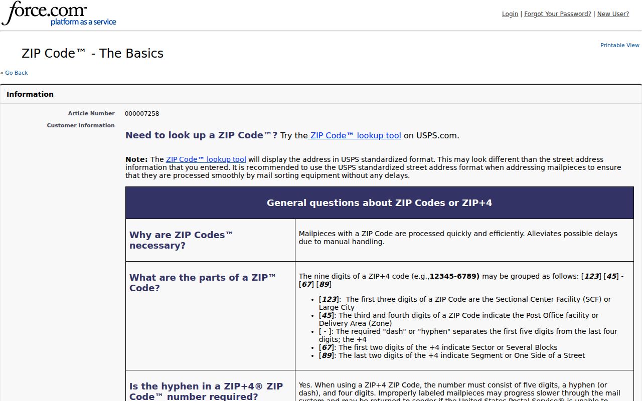
The USPS guidance reinforces the practical rule: confirm delivery with USPS, confirm municipality with the New Jersey tool and county parcel record, then use the appropriate public office for the record sought. A ZIP is a useful starting point, not a substitute for an address verification.